History of the Shawsheen River, part 3
In 2022, the Town of Andover commissioned the History Center to write the history chapter of the town's Master Plan for the Shawsheen River. This is part three of the chapter.
Welcome or welcome back to History Buzz! If you’re a subscriber to the Buzz, thank you! If you’re new here, or you haven’t become a subscriber yet, please sign up for a subscription to have History Buzz delivered directly to your inbox. If you can, please consider a paid subscription to support the research and writing that make History Buzz possible.
PART 3: 1700s
Read Part 1, the deep history of the area
Read Part 2, 1646-1700
Introduction
By the early 1700s, the settler population of Andover had grown and people were settling and building homes farther away from the Old Center and the Meeting House. The southern end of Andover was by this time more heavily populated that the original settlement.
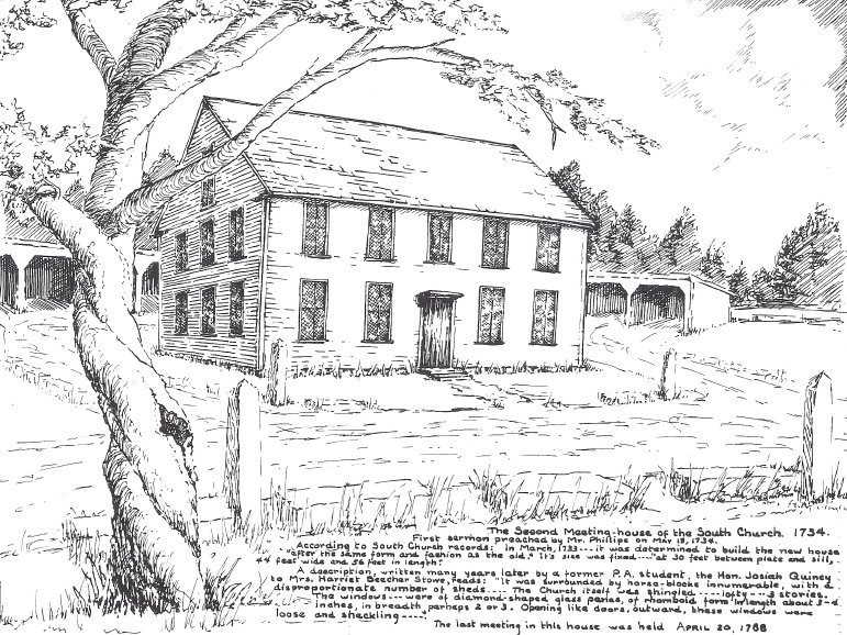
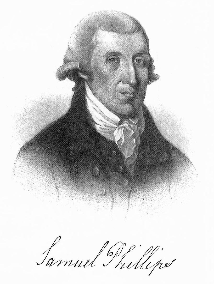
In 1705, the people of Andover voted to build a new meeting house and debate ensued over where to build a new meeting house that would serve the entire town. In 1708, the General Court of Massachusetts decreed that the town could support two churches and so would be divided into two precincts, each with its own church. The South Parish Church was “to be set at ye Rock on the West side of Indian Roger’s Brook.” October 17, 1711, the parish secured their first minister, 22-year-old Reverend Samuel Phillips.
18th century mills
Throughout the 18th century, more mills along the Shawsheen River were erected and operated as Andover’s industrial villages were formed. Additional saw mills and grist mills were erected, and the Chandler iron mill continued. New mill interests constructed during the 1700s included cider, fulling, paper, and gun powder mills.
In Ballardvale in 1753, Humphrey Holt sold to Asa Abbot one half of a sawmill he had erected on the “Shawshin” river near Pine Plaine, also known as Preston’s Plain south of Ballardvale.1 By 1794, Ballardvale Village held a sawmill, grist mill, and cider mill constructed and operated by Timothy Ballard.2 In her book Historical Sketches of Andover, Sarah Loring Bailey recorded that in 1771 a freshet3 “carried away Widow Ballard’s mill dam.”4
Further north along the river, other mills were constructed close to Thomas Chandler’s iron works.5 Two other Chandler brothers, Henry and Joseph, established a sawmill nearby. In 1745, the Lovejoy family purchased rights to a grist mill and a share of the dam that powered it.6 Joshua Lovejoy purchased the Chandler iron works on the west side of the Shawsheen River along with a 3/8th share of what was then called the Abbott/Lovejoy dam (where the Marland Mills would one day stand).
In the same general area, early in the Revolutionary War, the grandson of South Parish’s first minister, Samuel Phillips, Jr, saw the need for gunpowder and set up a gunpowder mill located on the Shawsheen River near the junction of what is now North Main Street and Stevens Street.
Phillips recruited friend and trained chemist Eliphalet Pearson to assist with the operation. The new mill on the Shawsheen River ran day and night producing 1,200 pounds of ammunition for the Continental Army. General George Washington was unimpressed by the quality of the gun powder and sent it back to the Andover mill. Phillips found skilled British prisoners of war and put them to work manufacturing a better-quality gun powder. Local residents feared the combination of enemies and gun powder in their midst. On June 1, 1778, an explosion at the mill killed three men and partially destroyed the mill. So great was the need for gunpowder during the war that the state sent Phillips money to rebuild the mill. At the end of the war, Phillips turned to the far less risky business of producing paper.7
Finally, in the north part of town, in the village that would be named for him, in 1718 Samuel Frye built saw and grist mills along the river. His son later added a fulling mill.
In 1765, a mill privilege on Hussey’s pond was deeded for a saw mill. Hussey’s Pond drains into the Shawsheen River. Over the next 150 years, a number of mills and other businesses were built between Hussey’s Pond and the Shawsheen River.8
18th century bridges
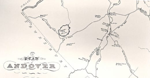
A 1795 map Andover shows bridges crossing the Shawsheen River. Ballard’s Bridge crossed the river near the Ballard mills. The “Roth Bridge” replaced what had been called “The Little Hope Bridge” at Central Street and Lupine Road. There was a bridge at Abbot’s mill, close to Roger’s Brook. A “new bridge” was constructed at the Phillips gunpowder and grist mill in the Stevens Street area. Further north, Frye Bridge crossed at Frye’s mill. Bridges were often, but not always, built close to mills. Causeways were used prior to the construction of bridges.
This third installment of the Shawsheen River history is a very brief introduction to area just after English settlement in 1646. You can read Part 1, the deep history of the area, by clicking here. Click here to read Part 2, 1646-1700. In our next installment, we’ll look at the history of the river in the 1800s.
Thanks so much for reading! Please leave a comment, like, and subscribe. You can help make History Buzz more visible to other history-loving readers.
~Elaine
Resources 1700s
Andover Historic Preservation website
Bailey, Sarah Loring, Historical Sketches of Andover, Massachusetts, Riverside Press Cambridge, 1880
Mofford, Juliet, Andover, Massachusetts: Historical Selections from Four Centuries, Merrimack Valley Preservation Press, 2004
Witheridge: Fulling: http://www.witheridge-historical-archive.com/fulling.htm
Historic Preservation website, 210 Andover Street
Historic Preservation website, 214 Andover Street
A freshet is the flood of a river from heavy rain or melted snow, Oxford English Dictionary
Bailey, Sarah Loring, Historical Sketches of Andover, Massachusetts, Riverside Press Cambridge, 1880, p604
IBID, 580
Historic Preservation website, 88 Lowell Street
Mofford, Juliet Haines, Andover, Massachusetts: Historical Selections from Four Centuries, Merrimack Valley Preservation Press, 2004, p66-67
Bailey, p580


