Miscellany Mondays: Amy Gordon Taft Reservation
A story of industry, agriculture, and land protection
Please help grow History Buzz by sharing this story! To share this post via email use the Share button below, then click on Copy Link, and paste that into your email to Share the Buzz. Or use one of the other social media options.
Below the meadows of Holt Hill opposite Salem Street is a woodland dotted with knolls, rocky outcrops, and wetlands.
In the Taft Reservation, evidence of human activity is abundant. The modern visitor is met frequently with stone walls, discarded metal, cart paths, and earthen dams.
Consequently, the curious researcher is not surprised to learn of the property’s long history.

Each early Andover settler received a house lot near the town center (now old North Andover town center) as well as a larger tract elsewhere, as dictated by the laws at that time. Beneficial to the minister, it protected his “city of God in the wilderness” from attack by Native American residents.
The typical settler received between four and ten acres, but some amassed much larger estates. Simon Bradstreet, businessman, investor, and partner in the Massachusetts Bay Company, was Andover’s largest landowner. He and fellow Andover founder Nicholas Holt were the first Europeans to own what is now the reservation.
In 1673, Bradstreet gave much of his land to his son Dudley. He nor his father lived here but looked forward to a return on their investment. By this time, fear of hostility from Native Americans subsided and people moved further from the town center.1
Robert Gray, a mariner, built a house near the intersection of Salem Street and Gray Road in 1679. It sat on five acres gifted to him by his father-in-law Nicholas Holt. Robert established the Gray Farm in 1699 when he purchased 100 adjacent acres from Dudley Bradstreet and Henry Holt Senior. The purchase likely included the northern part of the Taft Reservation near Vine Street.2
The Gray Farm included Gibbet Plain, the site of public executions for Essex and Middlesex County. This is now part of Harold Parker State Forest and not the Taft Reservation.3
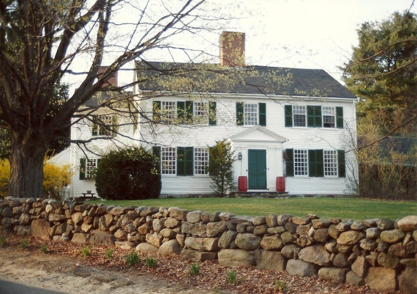
The Taft Reservation, especially near the house at 232 Salem Street, has a long history of industrial use. Like other remote Andover homesteads, the family produced everything they needed to survive on-site. In 1715, Henry Gray, son of Robert, owned a scythe grinding mill and later a blacksmith shop and weaving house.4 Several outbuildings like a granary, cider mill, shoe shop, and grist mill served other necessary functions over the years.5
Further into the woods, the visitor may spot the remnants of ponds used to power mills and hydrate livestock. The Gray and Holt families, who owned various parts of the present reservation, constructed earthen dams to impound tributaries of the Skug River.
On a darker note, David Gray hanged himself “in his barn with a linen string” on January 7, 1767, at the age of 50. The reason behind his suicide seemed unimportant to his contemporaries. Samuel Phillips, pastor of the South Church, instead used fear to discourage a recurrence. He published a sermon and denied Gray a burial in the South Church cemetery.67
According to Phillips’ instruction, the family buried him at the corner of Salem Street and Jenkins Road, where “his name [would be] consigned to oblivion.” Furthermore, they put a stake through his heart to keep “his unhappy soul from wandering.” His great-granddaughter Alice Gray reinterred him in the South Church cemetery in the late 19th century.8
It was David Gray II who built the current house in 1812, west of and up the hill from the original Gray house of 1699. Like the first David Gray, he also had a sour relationship with the South Church. He was a Universalist and got himself excommunicated in 1820.
In the latter half of the 19th century, the farm abandoned some of its industrial operations in favor of agricultural uses. A notable exception was the blacksmith shop that made farm tools and nails. By 1900, the Gray Farm had two houses, two barns, a carriage house, and two shops.
The farm was primarily a dairy farm in the early 20th century. In 1932, Reverend Arthur Taft, a minister from Colorado and former student at the Andover Theological Seminary, purchased 232 Salem Street and the surrounding farm as a retirement home.
Arthur and wife Amy Gordon had three children including Rebekah Lockwood Taft who inherited parts of their father’s estate in 1967.9

Rebekah lived in Colorado, but wished “to encourage children to love the beauties of nature.”10 She was a trustee of the Andover Village Improvement Society (AVIS) and worked with Harold Rafton to donate her land to the organization.
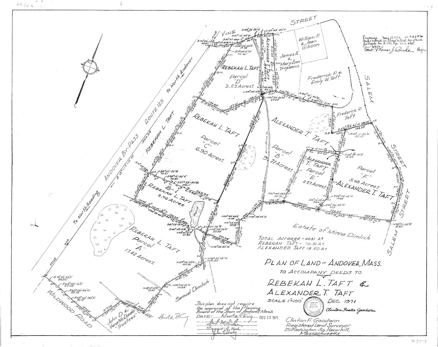
In 1972, 1974, 1977, and 1982, Taft made donations of various parcels totaling 34 acres. In her deed conveying the gift, she required the land be left “in its present natural, unspoilt, and unimproved state” and added that the land be named after her mother, Amy Gordon Taft.11
In 1994, a donation from the developer of Coventry Lane added 13 acres. In 1997, AVIS bought another 18.5 acres from the Taft family. The family still owns the 1812 homestead and outbuildings. Active AVIS members like Dick Hoyer and Nat Smith created and maintained the current trail system.12
At 65 acres, the reservation extends from Salem Street to Wildwood Road. Visitors can connect from the Ward Reservation or park on Vine Street. Trails circle former mill ponds and criss-cross stone walls. A large barn foundation is viewable near the Salem Street entrance.
Thanks to land conservation efforts, this history is available for all to enjoy.
For more information on the Taft Reservation, visit the AVIS website.
Juliet Haines Mofford, AVIS: A History in Conservation (Andover, MA: Andover Village Improvement Society, 1980), 199.
Ibid, 199-201.
Nancy J. Stack and Juliet Haines Mofford, “232 Salem Street,” Andover Historic Preservation, Andover Preservation Committee, 1975-1977, https://preservation.mhl.org/232-salem-st.
Mofford, AVIS: A History in Conservation, 201-2.
Stack, et. al., “232 Salem Street.”
George Mooar, Historical Manual of the South Church in Andover, Mass. (Andover, MA: Warren F. Draper, 1859), 99, https://archive.org/details/historicalmanual00south.
Mofford, AVIS: A History in Conservation, 202.
Ibid.
Ibid, 203.
Clinton F. Goodwin, Plan of Land in Andover, Mass. to Accompany Deeds to Rebekah L. Taft & Alexander T. Taft, Plan #6606, (Lawrence, MA: Essex North Registry of Deeds, December 1971).
Essex North Registry of Deeds, Rebekah L. Taft to Andover Village Improvement Society, Book 1193 Page 225, (Lawrence, MA: Essex North Registry of Deeds, May 18, 1972).
Mofford, AVIS: A History in Conservation, 204.


First, the 1811 Gray house was built around the earlier Thomas Holt (3) house built in 1708. Thomas Holt's grandson William Holt (5) sold the house and 29 acres to David Gray in 1795. David had lived in the infamous David Gray house across the road until 1811.
.
Nicholas Holt (1) married Widow Hannah Bradstreet Rolf on June 12, 1658 at Ipswich. Nicholas adopted the young children of Hannah Bradstreet Rolf including her daughter Hannah and her brother..
The Hannah, daughter of Nicholas Holt and Elisabeth Short who sailed to Boston with her parents died shortly after they settled in Newbury in 1635 but was not recorded.. Another tell is that Robert Gray (1) and Hannah Holt aka Rolf were married in Salem in 1668 and the first 5 children were born in Salem. The last child born to Robert (1) and Hannah was Aaron Gray, born April 14, 1692 in Andover. Nicholas Holt's daughter Hannah (2) would have been 60 years old at that time and that nativity seems very improbable. Hannah Rolf Holt would have been in her early 40's by then.
The deeds between Robert Gray (1) and Dudley Bradstreet and Henry Holt seem much more plausible with that connection. BTW, my records have Nicholas Holt (1) deeding to Robert Gray (1) mariner, a 10 acre parcel at the south end of my lands. Robert Gray's house site would be where the Caleb Abbot house is marked on the 1830 map. It was just west of the junction of Tucker Road and Gray Road.
I do have a town record saying that the said road (Gray) was alter to run south of the house. Part of Gray Road was the original way to Salem. It ran along the present Gray Road by Holt's Dam and Flume to the present town line and ran southeast across Aslebes Farm until it was altered around the time of the Revolution. Salem Road then ran south at it's present path and after crossing the Sgug River, it turned more southeaster out to the present Jenkins Road and down Jenkins Road and the left below Aslebe's Pond and out to the present Middleton Road by Beery Pond in North Andover.The present Salem Road was built in 1806-7 by the county and formed the present 4 corners.
The old Salem Road is still extant and a lot of it is owned by AVIS...
The practice of adopting stepchildren and said children taking their step father surname was common especially in the 17th century but lessened some as the Puritans became Yankees..
I have many, many, many old deeds of Holt, Gray, Jenkins, Russell, holdings from spending hours at Salem/Essex Probate..
The AVIS property is the Scug River Reservation that contains part of the 1770-1807 Salem Road...