From the History Buzz Archives: An Update on the Andover-Wilmington Railroad
What's It Wednesdays: It's all about the line
Welcome or welcome back to History Buzz! If you’re a subscriber to the Buzz, thank you! If you’re new here, or you haven’t become a subscriber yet, please sign up for a subscription to have History Buzz delivered directly to your inbox. If you can, please consider a paid subscription to support the research and writing that make History Buzz possible.
In September 2020 before History Buzz was debuted, What’s It Wednesday writer Marilyn Helmers shared a story about an old railroad rail that found its way into the History Center’s collection. Today, we’re sharing her story again with an update.
Fast forward to February 2023 when writer Tom Adams gave a talk on trains in Andover. One of our guests shared that he has been searching for a map of the original route of the Andover Wilmington Railroad. A few days later, another guest sent us a link to – not only a map – but the “First Report of the Directors of the Andover and Wilmington Rail Road Corporation with that of the Engineer,” dated October 31, 1834.
Later in this post, we’ll share excerpts from the report, the map, and a link to the document on the Hathi Trust website.
It’s all about the line
Marilyn Helmers, September 2020
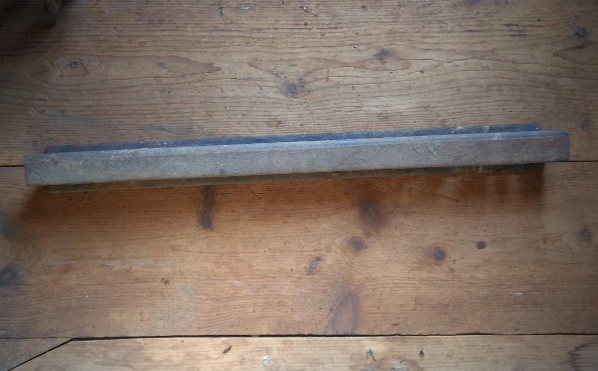
Five years ago, we got a call that an old rail had been dug up during a renovation of a house on Abbot St. Of course we had to investigate.
We found this rail from a railroad track. But not just any track. This is part of what once was the Andover-Wilmington railroad line - one of the first railroad lines in Massachusetts.
It all started in 1833, with Andover resident Hobart Clark who gathered in Locke Tavern with other prominent Andover men, Abraham Marland, Amos Abbot, John Smith, and Merrill Pettingill, with the intention of starting a rail line. The first railroad in Massachusetts, the Boston-Lowell railroad, was being planned and Andover wanted to have a rail connection. The group petitioned the Massachusetts legislature for permission and the Andover and Wilmington Railroad Corporation was chartered in March 1833.
Planning began for the 8-mile connection that would bring rail service to Andover and its mills. The Boston-Lowell line opened in 1835. The Andover-Wilmington line opened in the summer of 1836.
First Report of the Directors of the Andover and Wilmington Rail Road Corporation with that of the Engineer,” dated October 31, 1834.
To the Stockholders of the Andover and Wilmington Rail Road Corporation
Gentlemen:
The present Board of Directors have now the honor to present to you a statement somewhat in detail, of the proceedings of the Directors from the first organization of the Corporation, which was in June, A.D. 1833.
The first measure of importance taken by your Directors was to procure an Engineer to make such surveys and estimates as were necessary, to enable the subscribers to the stock to decide on the practicability and expediency of the undertaking.
In selecting an Engineer, it was the object to obtain a gentleman of experience and high professional attainments, whose report would be entitled to your full confidence. This was a task found to be a more difficult task than was at first apprehended – Engineers being at this time much engaged in similar projects.
The Directors contracted with Colonel Loammi Baldwin, who, being very busy with other contracts, started the work and then handed it off to his associate, Mr. Pratt “his most experienced Engineer.”
The report lays out the two paths – named the Eastern and Western lines – engineers researched to determine the best path of the rail line. Description of the routes depends on one knowing the names and locations of properties and owners along the way. There are a lot of “thence’s” in the description.
The first line was commenced at the Bridge of the Lowell Rail Road, near Col. Jacques store in Wilmington, thence following the Andover Road, as far as Richardson’s house, near Wilmington Meeting House; thence bearing westerly, and passing on the west side of said Meetinghouse; thence northerly over the low ground and Lubber Brook to the Salem and Tewksbury Road, about forty rods to the west of the house of William Blanchard, Esq.; thence crossing said Road and continuing the same direction over said Blanchard’s farm and the Harnden farm, to the west Andover and Wilmington Road, near Thomson’s house about twenty rods to the west; then bearing a little to the west and crossing said Road again, and passing over the farm of William Burt about four rods westerly of Burt’s house; thence to the valley of Chandler’s Brook (or Foster’s Pond Brook) then bearing easterly on the side of the Meadow on said Brook; thence over said Meadow, crossing said Brook about forty rods westerly of the Chandler’s bridge, and so about the same direction over Mear’s Plain to the head of said Plain, near the house of Isaac Goldsmith, Jr.; thence crossing the old Boston and Haverhill Road, and bearing more northly over the land of Nehemiah Abbot and land of Ezra Abbot and other, nearly parallel to the general course of said road, to a point in the Road behind Mr. Locke’s Tavern, near the house of Peter French. The length of this line is 7 80/100 miles. Rise from the Lowell Rail Road at Jaques’ Bridge, 71 37/100 feet. This is called the Western Route.
The description of the Eastern Route was similar.
The Engineer’s final report, “From the view I have taken, in company with you and other gentlemen interested in the inquiry, and from having personally attended two days in the commencement of the survey, I have no doubt, a highly favorable route for the contemplated road may be found, and even much more so than, on my first view, I had supposed. . .Upon the whole, the appearances and character of the country over which this Rail Road is contemplated, are very favorable to the project.”
His report includes the rise and elevation of each section of the proposed rail line. He offered an alternative to what he called the “embarrassments” of “vallies” at Chandler’s Brook and at Goldsmith’s house.
The cost of the nearly 8-mile line was estimated to be “$77,002.20, exclusive of expense of Engineers and other contingencies.” However, “No calculations have yet been made as to the amount required to be paid in damages for land and fences.”
One can imagine that would be a substantial cost these days.
Addressing the question of how much income the rail line would provide stockholders, the Directors presented data on comparable lines in other parts of Massachusetts and New England. They compared the amount of traffic currently traveling via stagecoach and estimated that 15,681 passengers would potentially travel on the new railroad.
The stage fare has usually been one dollar each way. Suppose the fare on the Rail Road to be seventy-five cents, the number of 15,681 passengers would amount to the sum of $11,760.75.
The daily cost of running the Engine “will be at [the] present high price of fuel be $16” in payments to the Engineer ($2), the Assistant ($1.50), plus coal ($8), oil ($.50), repairs ($2.50), interest ($.75), and contingencies ($.75). Tolls paid to the Boston and Lowell Rail Road Corporation for using part of their line would have to be figured in.
The Directors note that these early calculations do not take into account all the potential income from agricultural and manufacturing transportation. Other successful railroads carry “agricultural productions, lime, timber, lumber, fire wood, paving stones, plaster of Paris, coal, boards, bricks, and scrap iron.”
When articles so varied, and some of them of so small value, can be carried profitably to their owners . . . no doubt can exist as to the profits of both on Merchandize and Passengers.
All of which is respectfully submitted,
Hobart Clark
Abraham Marland
Amos Abbott
John Smith
Merril Pettengill
Andover, October 21, 1834
Later in the report, Engineer Joshua Barney’s cost estimates included the costs of the engineers and contingencies. The $87,002.02 cost of constructing the railroad was laid out in great detail. Mr. Barney’s report ended with a short paragraph estimating the cost of the engine and cars of about $20,000.
I have no doubt that a capital of One hundred and ten thousand dollars will be found fully adequate to put the road in successful operation.
Very respectfully, Sir,
Your obedient servant,
Joshua Barney
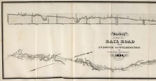
Below is the map of the proposed new Andover and Wilmington Railroad, with elevations.
Click here to read the whole document and map on the Hathi Trust website.
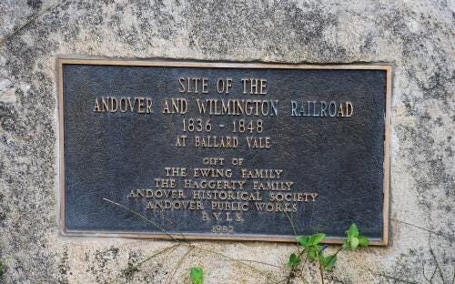
To put some of the “thence’s” and resident names from 1834 into landmarks that are more familiar today, we’ll start with the commemorative stone marker at the walkway at 264 Andover Street beyond the South School playing field.
Across the street at 265 Andover Street is the house that was originally the railroad depot, the first stop on the line. The depot agent made sure residents traveling along Andover Street would stop when the train came. There were no crossing gates, so flags were used to stop traffic.
From Andover Street the railroad tracks ran down through what is now the Andover Recreation Park. The current road was the old rail bed. It crossed Abbot Street and ran through land that is now the Spring Grove Cemetery. Evidence of the old railroad bed can still be seen at the main entrance to the cemetery. Then the tracks continued down the southeast side of Abbot Street, crossing School Street and then Central Street where Chestnut Street intersects. It ended at the Andover Depot on Essex Street. The depot was where the back entrance to Memorial Hall Library is today.

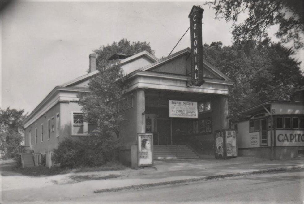
This structure, formerly at 9 Essex Street, was built as the Andover & Wilmington Railroad terminus depot and passenger station in 1836. After the railroad line was relocated, the building saw many uses. It was a furniture store, a plumbing business, movie theater and then the town’s senior center. In the 1980s, it was cleared for the expansion of the Memorial Hall Library.
In the 1840’s, railroad travel was expanding, and new lines were being added throughout Massachusetts. The Andover and Wilmington, and other short lines, were absorbed by the Boston and Maine railroad. In 1846, the railroad was relocated nearer to the Shawsheen River to be closer to the mills of Ballardvale, Marland and Abbot Villages. The line was extended to North Andover through what is now the Shawsheen Village area and into the new city of Lawrence. By 1848, the Andover and Wilmington railroad line was abandoned.
Want to know more about the Andover-Wilmington route through Andover? Please check out https://andoverhistorical.org/research-highlights.
Thanks for reading! You can be a part of the History Buzz community by leaving a comment, liking, or sharing this post.


This is a neat story. For a long time, I had Andover-Wilmington confused with the "wildcat" branch that runs between Ballardvale (just south of the station) and Wilmington center. In my commuter rail days I loved that routing because the Haverhill line stops at every fence post in Melrose
That is fascinating! The train in the picture looks just like George Stephenson's Rocket, the first passenger train in England, but then, why wouldn't it? 😂 Marvelous that a bit of the track was found. Anyone who's a bit of a train geek might enjoy actually traveling on a reproduction of a similar train at Beamish, the living history museum in the North of England. I rode it in the rain, which was as miserable as it sounds: https://youtu.be/H4kTHuB3_k4